Sunday, June 24, 2012

BONUS: Sylvan Lake Shore

Unfortunately, Pamela's work schedule has really restricted our hiking time lately. This weekend was no exception. However, my parents came to visit us and my sister which allowed us the opportunity to hike a bonus trail - that's a trail in our guide book but not on our list of 52 because we've previously hiked it together.

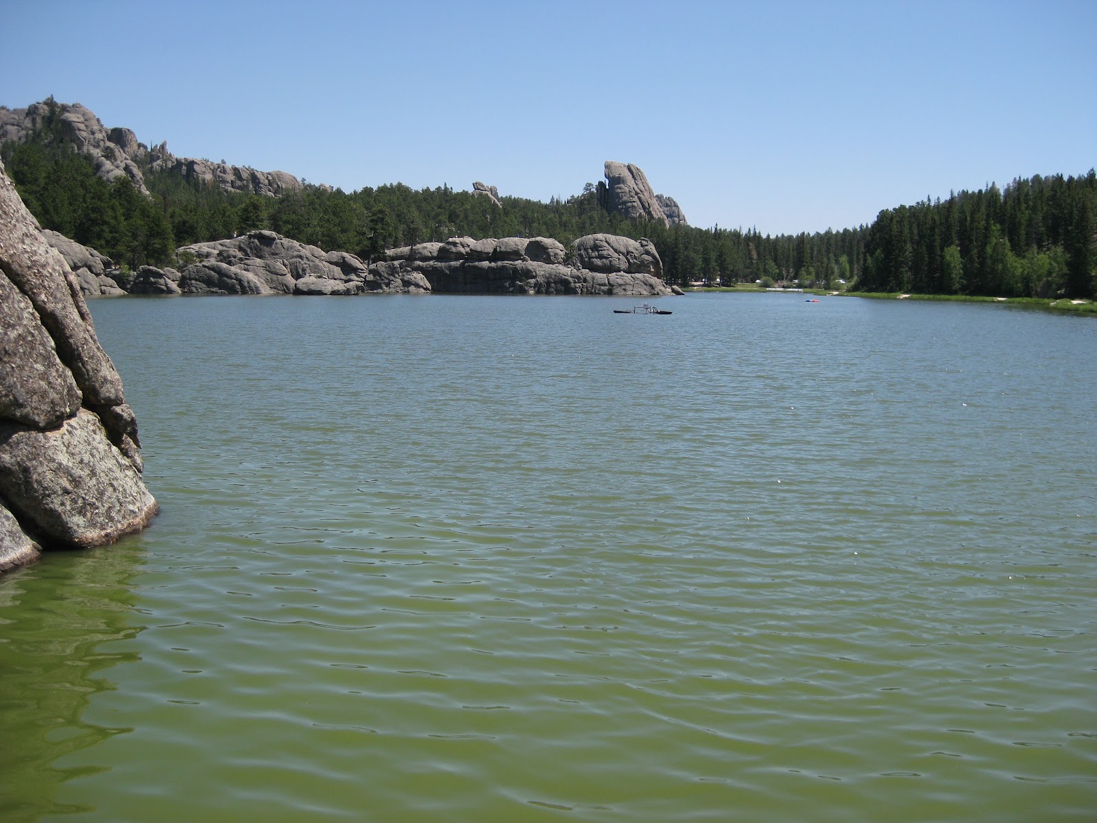
I've wanted to hike this trail with my family for quite some time. The trail itself is typically flat enough that it's easy if you want it to be, but the impressive granite outcroppings provide a unique challenge for even amateur rock climbers. Of course, the icing on the cake is the beautiful lake, perfect for water recreation. On this particular occasion, we didn't take advantage of the lake, but we did enjoy the other two options.

My family knew even before this weekend what I had planned. My father confessed that on their way out to Rapid City Friday, he told my mother sarcastically, "That's just what I want to do on my day off...climb a mountain!" If you know my father, you can perfectly envision him saying this. Ironically, once we started climbing, guess who was usually the first one to say, "Oh yeah, we can go higher." He scrambled up those rocks like a mustached teenager.

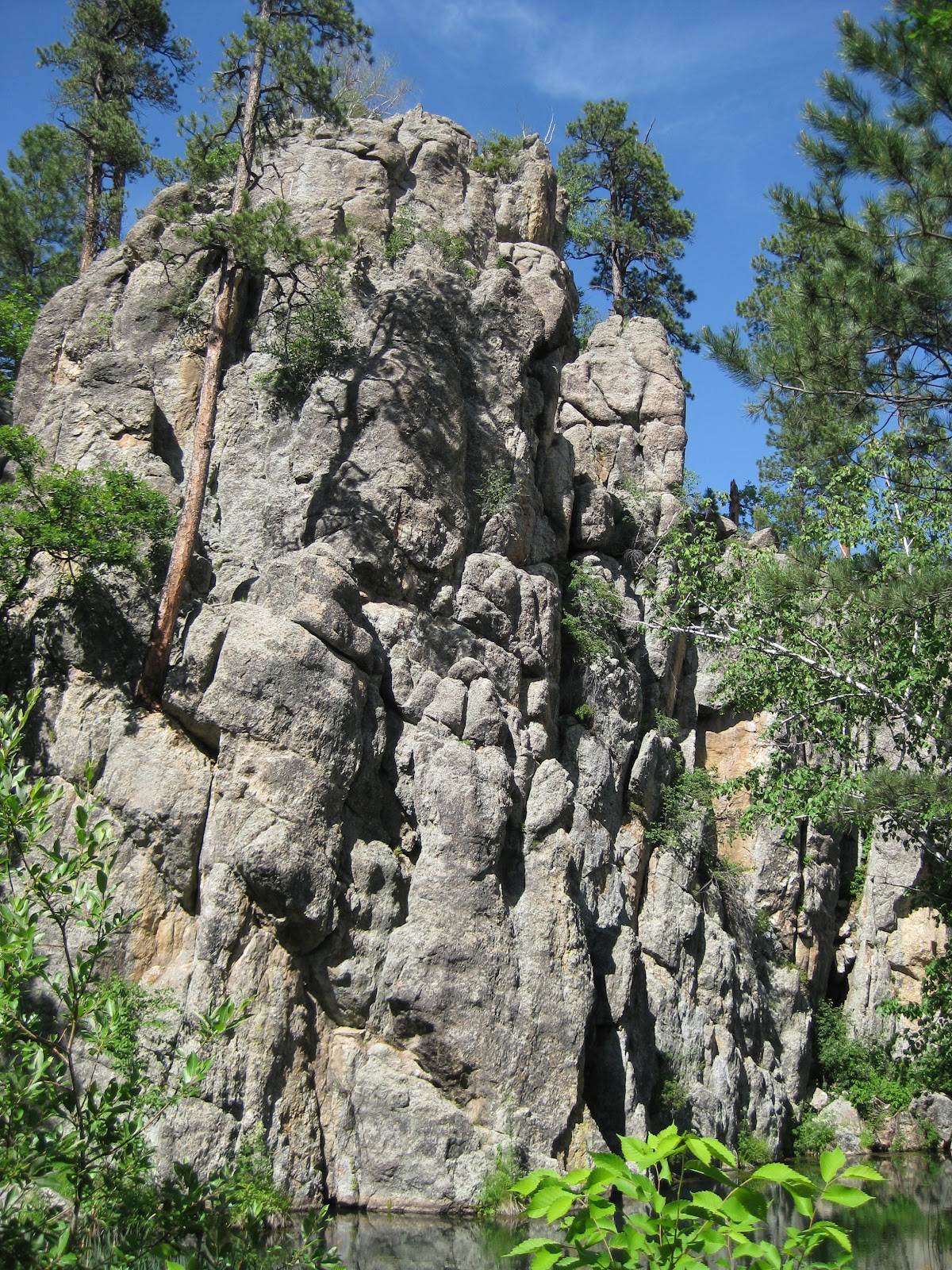
I've always had a very healthy fear of heights. Through a number of obligatory situations, that fear has diminished, but I'm still no daredevil. Nonetheless, I kept up with the others. To keep us connected even when we couldn't see each other, we used a loud "caw, caw" call. (This is used in a movie, but we can't remember which. Anyone who can think of it and post a video link will be my new best friend.) Some people might be embarrassed to shout like a bird in a crowded public place, but we let our voices echo through the area without hesitation. In fact, we later heard another group copying our idea and using a very similar "coo, coo" call. I never thought my family would be trendsetters. I know there are multiple valid reasons a person may opt not to be a rock climber, but if Sylvan Lake is great from the trail, it's absolutely spectacular from the peaks! Being that high with the breeze blowing in your face makes you feel like you can achieve anything.

Even though I've now hiked this trail at least two times, I can't wait to go back again. Next time, I hope Pamela and my other sisters can join us. I know we could spend hours there climbing and exploring many other points. I also know I'm not the only one eager to go back. I noticed my dad looking longingly at the distant spires as we hiked back to the parking lot.

(Since Pamela was not with us to track our hike on her phone, I have no stats.)


It takes balance to cross to the bridge overlooking the spillway. After getting there, Mom called it "stupid." It was pretty unimpressive.


Danielle's boyfriend, Brady, wanted to cool off.


Some passages were quite narrow. In most cases, there was more than one reasonable route.

Dad can't get over how big some of the rocks are here. It's much different than back home.


This was taken from the highest point we reached.


Wednesday, June 13, 2012

#4 Creekside

We had to be back in Rapid City at a specified time this evening and had to plan accordingly. In order to cover two trails in our limited time, we biked Creekside Trail rather than hiking it. Its paved surface made the ride easy and quick. We could have started across the road from where we started our hike but decided to start at the State Game Lodge instead. It turned out to be a good choice, as the return ride back to the lodge was easier than the ride out to the Grace Coolidge camping area.

The scenery along this trail didn't compare with that of the previous, but it was relaxing and fun to ride. We were able to see three young bighorn sheep grazing in an open field along the path.

Total Distance: 3.59 miles
Elevation Gain: 503 feet
Max. Elevation: 4,350 feet
Total Time: 31 minutes
Moving Time: 24 minutes
Average Moving Speed: 8.86 mph


#3 Grace Coolidge

I know it's very early in the game, but I would say today's hike is going to be hard to beat. The trail beginning at the Grace Coolidge walk-in fishing area in Custer State Park was pleasant and beautiful. I would agree with the trail's "easy" rating. Much of the terrain was quite flat. The fifteen creek crossings proved to be the greatest challenge, but each had stones and/or logs on which to step. The sign at the trailhead guaranteed we'd get wet at these crossings, but clearly that warning doesn't apply to expert hikers like us.

We saw and heard more wildlife on this hike than on the first two, which I appreciated. There were more birds including a lone turkey hen. We also saw many small fish in the creek, two marmots, and seven small snakes. A rattlesnake encounter is probably my top concern when hiking the Hills, but the snakes we saw today were very nonthreatening.

Pamela and I agree our home areas farther east in South Dakota and Iowa can provide breathtaking views (Side note: If you haven't before, you must watch a thunderstorm roll in across the prairie and get lost in the millions of visible stars in the enormous night sky.), but being surrounded by the combination of water, rock, and lush vegetation this time of year in the Hills is something very special. The photos we took can only give you a taste of that experience. I would recommend everyone who lives in or visits the Black Hills enjoy this trail. You can go for a short hour or two walk, or spend a long afternoon fishing the creek. It's accessible for anyone and will not disappoint.

Total Distance: 6.38 miles
Elevation Gain: 1,989 feet
Max. Elevation: 4,725 feet
Total Time: 2 hours, 18 minutes
(most of our stationary time was spent examining creek crossings)
Moving Time: 1 hour, 44 minutes
Average Moving Speed: 3.65 mph


I decided to walk out over the creek on this fallen tree just for fun. 

It turned out to be less fun than I anticipated.

Most creek crossings have plenty of stones to provide relatively simple routes across. At no point was the water more than ankle deep.


Log bridges were also present at some crossings but tended to appear less trustworthy.


The largest snake we saw was only about a foot long. They were all hanging out in or near the creek.


The trail was generally clear and easy to follow, but obstacles like this are to be expected from time to time.


I don't believe this service road is part of the official trail, but we followed it about 1/2 mile to the top of a ridge.


Can you see the turkey?