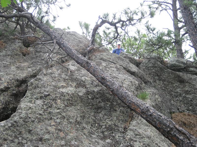
This trail was a winner! It started near the Iron Creek picnic area, although the trailhead was not immediately visible as indicated in our book. The trail was easy near the beginning - somewhat rocky with a gradual decline. At this elevation, there was little ground cover and just a few aspens among the ponderosas. This area also included some rocky outcroppings great for climbing. Pamela and I weren't as adventurous today as I was with my family at Sylvan a few weeks ago, but I did climb to one point that provided some beautiful views. Thankfully, this area has not been devastated as significantly by pine beetles and was still mostly green.
As we continued down toward the creek, the scenery changed. A healthy growth of grass covered the ground on either side of the trail. In some spots, openings in the pines looked like miniature meadows. There was plenty of evidence that the area had received rain the night before. Based on the greenery, it appeared rain here has been more prevalent throughout the summer than in other parts of the state. By the time the creek came into view, the vegetation was diverse and abundant. Grasses, flowers, and shrubs of all kinds crowded the trail as a combination of coniferous and deciduous trees towered above. The creek itself was not necessarily impressive, but a pleasant addition nonetheless. This is the kind of environment I enjoy the most.
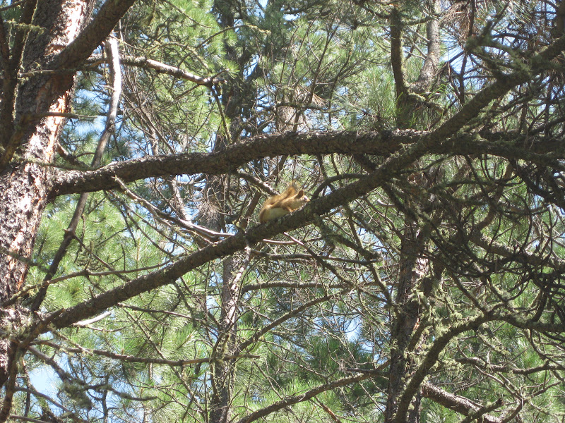
The forest played home to many animals. On this trip, we saw many butterflies, a deer, quite a few chipmunks, and a few red squirrels. For obvious reasons, this trail was one of only three thus far on which we encountered other people. The trail is frequented by horse riders. We met two on our way down, enjoying the morning tranquility and a Bud Light. Near the end, we had a brief chat with another hiker. He asked about our route and was kind enough to offer us a drink...of water.
The only complaint we might have about this trail is the order in which you ascend and descend. Needless to say, it's preferable to go up first when you're fresh and come back down when you're tired and the temperature is rising. The last two miles weren't the most enjoyable we've had, but they definitely weren't the worst we've tackled either. Overall, the trail was quite manageable for even a novice hiker with options along the way to make it more challenging if desired. It was a great balance all around and one we will likely consider revisiting in the future.
As we continued down toward the creek, the scenery changed. A healthy growth of grass covered the ground on either side of the trail. In some spots, openings in the pines looked like miniature meadows. There was plenty of evidence that the area had received rain the night before. Based on the greenery, it appeared rain here has been more prevalent throughout the summer than in other parts of the state. By the time the creek came into view, the vegetation was diverse and abundant. Grasses, flowers, and shrubs of all kinds crowded the trail as a combination of coniferous and deciduous trees towered above. The creek itself was not necessarily impressive, but a pleasant addition nonetheless. This is the kind of environment I enjoy the most.
The forest played home to many animals. On this trip, we saw many butterflies, a deer, quite a few chipmunks, and a few red squirrels. For obvious reasons, this trail was one of only three thus far on which we encountered other people. The trail is frequented by horse riders. We met two on our way down, enjoying the morning tranquility and a Bud Light. Near the end, we had a brief chat with another hiker. He asked about our route and was kind enough to offer us a drink...of water.
The only complaint we might have about this trail is the order in which you ascend and descend. Needless to say, it's preferable to go up first when you're fresh and come back down when you're tired and the temperature is rising. The last two miles weren't the most enjoyable we've had, but they definitely weren't the worst we've tackled either. Overall, the trail was quite manageable for even a novice hiker with options along the way to make it more challenging if desired. It was a great balance all around and one we will likely consider revisiting in the future.
Total Distance: 5.96 miles
Elevation Gain: 302 feet
Max. Elevation: 6,114 feet
Total Time: 2hours 47 minutes
Average Speed: 2.13 mph


 See the trail down there?


 Proof that it does rain in South Dakota


 We wish we could have a chipmunk as a pet. They're so darned cute!


 One relatively small area was completely littered with dead pine needles.


This rock formation looks quite a bit taller from the top. I know.


Pamela's rock climbing experience


The climb was well worth the view.


Technically, we hiked one entire trail and portions of two others today, but we're only counting it as one.

False advertising: We didn't see any elk.


Even I was lacking the ambition or courage to climb this peak.


Go team!
One of the famous pigtail bridges
No comments:
Post a Comment